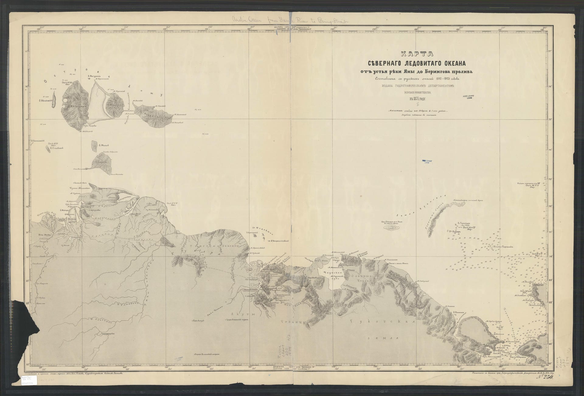
Karta si︠e︡vernago Ledovitago okeana otʺ ustʹi︠a︡ ri︠e︡ki I︠A︡ny do Beringova proliva [Карта сѣвернаго Ледовитаго океана отъ устья рѣки Яны до Берингова пролива]: Map of the Northern Arctic Ocean from the mouth of the Yana River to the Bering Strait
The map below, printed in 1874 by the Russian Imperial Hydrographic Department of the Naval Ministry and based on surveys of Russian imperial explorers from 1821-1823, depicts the far northeastern reaches of the Russian Empire up to the Bering Strait, which separates Russia from Alaska. Alaska had been sold to the United States by Russia only seven years prior to the map’s creation in 1867. Chukotka, the land that today marks the easternmost part of Russian territory, was among the last areas of Siberia/the Far East to come under Russian control in 1778.
The expeditions referenced by this map likely refer to the travels of Ferdinand von Wrangel (1797-1870), a Baltic German explorer, and Fyodor Matyushkin, who together explored much of the Russian Far East, discovering the southernmost Medvezhy Islands and the area around the Kolyma River between 1821 and 1825. Along their journeys, they also collected ethnographic information about the native peoples inhabiting these areas, including the Yakut, Chukchi, and Chuvans.
On top of von Wrangel’s fame as an explorer, he served as the chief manager of the Russian-American Company, essentially the colonial governor of Russia’s commercial Alaskan settlements, from 1830 to 1835. In this post, based in the settlement of Novo-Arkhangelsk (Sitka), Alaska, he was known for being an administrative reformer who pushed for greater agricultural development and expanding infrastructure. In an attempt to formalize and make sustainable the fur trade on which the Russian-Alaskan Company was heavily dependent, he also implemented efforts at conserving the sea otter population through closed hunting seasons to allow time for them to reproduce, a relatively progressive policy for the time. Von Wrangel also recognized the Company’s dependence on the native Aleut population, who were far more skilled in sea otter hunting than the Russian traders. As such, he continued his ethnographic observations and was generally known to be more humane towards the Native peoples, despite occupying a role built on exploitation. After his time as chief manager, he later became a founding member of the Imperial Russian Geographical Society in 1845. He was strongly opposed to the sale of Alaska to the United States that would ultimately occur three years before his death.