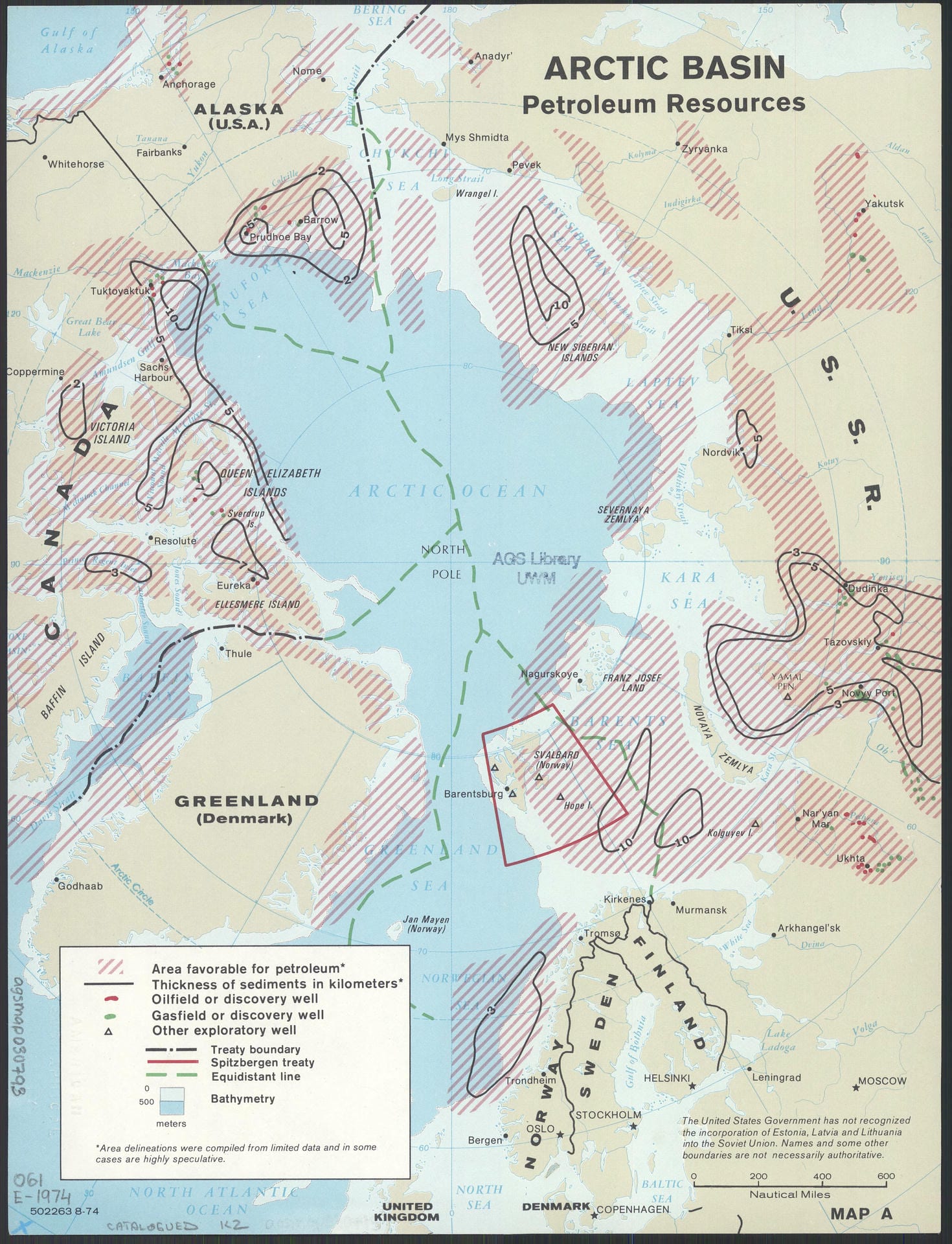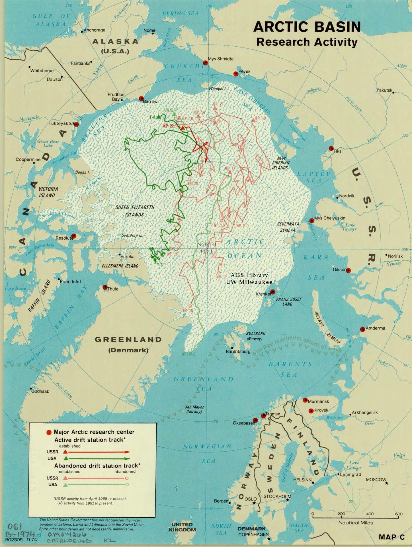
Arctic Basin petroleum resources, Arctic Basin Established and Theoretical Jurisdiction Limits, Arctic Basin Research Activity
The following three maps, created by the United States Central Intelligence Agency in 1974, highlight various strategic considerations of the United States government in the Arctic region at the height of the Cold War: the location of petroleum reserves, the United States and Soviet Union’s major Arctic research centers, maritime boundaries, population centers, and the bathymetry of the Arctic Ocean and surrounding waterways. While sites of Cold War competition are most frequently understood to occur across the European, Asian, and African continents, these maps reveal how the northern Arctic region existed as a site of serious strategic consideration for the United States. Indeed, the closest and most direct path between the United States and the Soviet Union went north, not east or west.
Contestation and competition are evident in these maps. For example, the second map highlights the established and “theoretical” jurisdiction limits of the Arctic Sea, combining treaties with competing projections and claims such as sector zones (the red dashed lines), equidistant areas (the green dashed lines), and the 200 nautical mile limit (solid green lines). Before the 1982 United Nations Convention on the Law of the Sea (UNCLOS), maritime boundaries not defined by treaty were often left unresolved or governed by customary practice, leading to competing claims over where these boundaries existed. This 1974 CIA projection underscores the significance of these legal discrepancies in determining which Arctic areas might be subject to future claims, which is particularly relevant given the focus on petroleum resources in the first map. While the United States still today has not ratified the UNCLOS, Russia, Canada, and Denmark are signatories, allowing them to submit legal claims over disputed maritime and continental shelf boundaries, particularly the Lomonosov Ridge.
A final piece of interest is the note featured on the first and third maps, which states that the United States has not recognized the Soviet Union’s annexation of the Baltic states of Estonia, Latvia, and Lithuania. While such a disclaimer does not feature on all Cold War-era maps from the United States that feature the Soviet Union, it further reinforces how cartography and the “north,” broadly defined, represented sites of contestation.